The Office of Research and Center for Coastal Climate Resilience are supporting a one-year pilot of an organizational subscription to support a wide variety of research across campus.
What is Planet?
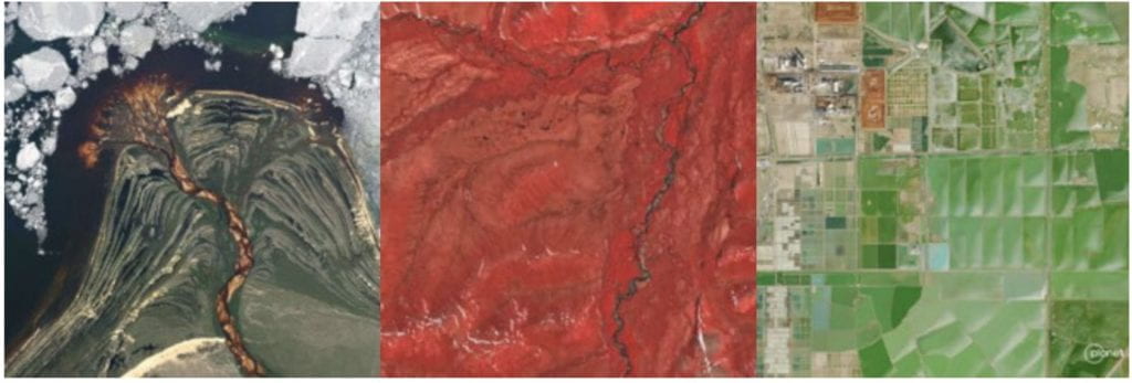
Planet is a leading provider of satellite imagery, capturing our dynamic planet’s changes, patterns, and developments with high precision. Planet’s constellation of Earth-imaging satellites provides high-resolution, frequent imagery capture across the globe. The Center for Coastal Climate Resilience is sponsoring pilot access across campus for one year.
To access Planet, fill out a request form.
This powerful resource offers unprecedented insights into our changing planet and numerous research opportunities. Uses include examining regional change over time (daily, weekly, monthly, quarterly), and performing analyses such as land cover classification and vegetation health assessments. By requesting a Planet account, UC Santa Cruz students, staff, and faculty can gain access to:
- Near-daily 3-meter PlanetScope satellite imagery.
- High-resolution SkySat Archive (older than 6 months).
- Extensive training materials through Planet University.
- A community of remote sensing scientists and educators on Planet Community.
Geographic coverage: global
Average resolution: 3.7m
Temporal coverage: from 2009 (some limits) to present
Planet Support and Training
- Training tools: Learn about Planet’s data and capabilities on Planet University.
- Find developer resources: Extensive documentation is available on Planet’s Developer Center.
- Join the conversation: Get tips and best practices from your peers.
- Get support: Request a password reset or get any help with using Planet: email support@planet.com.
How to cite Planet
For journal articles, use the following citation:
- Planet Team (2017). Planet Application Program Interface: In Space for Life on Earth. San Francisco, CA https://api.planet.com/
For figure captions, use:
- “Image Ⓒ[year of capture], Planet Labs PBC.”